Saturday, 5 November 2011

Spatial Tool (Geographic Information Systems)

A Geographic Information System (GIS) is a tool that connects databases to maps. It combines layers of information about where things are located with descriptive data on information such as locations, roads and parcel sizes all stored digitally in the system in layers called themes. The GIS has revolutionised planning as planners are now able to capture, store, manipulate, manage and present data efficiently and effectively. There are two types of data that the GIS can contain vector data and roster data.

Vector data contains information about points, lines or polygons. Points represent benches, lights e.g. physical items, lines represent streets, water, electrical and sewer lines and polygons represent parcels of land, buildings and landscaped areas.
Roster data on the other hand contains information about the earth’s geographic features which are stored in cells and represent land use, vegetation, slope, elevation and aspect.
GIS Functions:
Query by Location - that is it can search any point within a polygon radius.
Query by Attribute - which is a search on data stored in the hardware e.g. identifying parcels of land and their owners.
Boolean Queries- which are a combination of query by location and query by attribute. E.g. the software could find all parcels less than 0.5 acres in size owned by people with the last name smith.
Buffers- Geographic regions that can depict spheres of influence and areas that are more significantly impacted by a given phenomenon e.g. a flood. 
Measuring Distance- Can calculate how far things are apart (distance) both straight and curved lines. 
Overall the introduction of the GIS has reshaped planning allowing planners to gather and interpret data and make decisions that maximise the potential of cities and inevitability will be the future of all planning decisions.

Friday, 4 November 2011

Metropolitian Regions

A metropolitan area is a combination of urban agglomerations that consists of a densely populated urban core that encompasses multiple jurisdictions and cities that share various infrastructure, services, housing and employment resources.  Metropolitan regions are also described as matrixes of developments that extend over wide areas and include many centres. A major metropolitan region that is discussed throughout the reading is the highly urbanised north-eastern sea bored of the United States which is a major metropolitan area that stretches from Boston to Washington in a 600 mile continuous corridor. This mass agglomeration is possible as the enormous region which is dominated by several older cities and masses of suburban development is linked by a modern and efficient rail and highway system which is used by the communities to commute to services and employment in major cities in the region such as Boston and Washington. Another major metropolitan area in the United States is the San Francisco metropolitan area often referred to as the Bay Area which includes urban areas such as the city of San Francisco, Oakland and San Jose and is home to about 7.15 million people within 9 counties.
                                                    San Francisco Bay Area:
Negatives of the Metropolitan Region:
New developments on the urban fringe are a modern and common practice in emerging and expanding metropolitan regions as business and services relocate to the urban fringe for the convenience and to be closer to the people who live in these areas. This however leads to negative trends such as the abandonment of older inner city developments which than become an eyesore on the city whilst also leaving land to be vacant, and not efficiently used. Over the next generation the traditional city centre will no longer be the only venue were business, finance, cultural and entertainment events occur as increasingly these will be dispersed to other parts of the Metropolitan region, closer to where patrons and residents live. The extent of the negative impact this will have on the inner city is unknown and whether to continue expanding metropolitan’s at the cost of the once vibrant urban inner city centre is a debatable issue were a correct answer currently is unknown. I believe although it is necessary for a portion of services to be close to the outer suburbs the inner city should be consolidated and never left to be run down but a vibrant area for business and tourism.

Town Plan - “How to Make a Town”

This week’s reading “How to Make a Town Plan” explores the key principles urban designers and planners follow to create communities that blend the natural and built environment, enhance vitality and increase the pleasure and comfort of its residents.
The following are principals that should be followed to achieve the above goals:
Regional Considerations:  Ideally growth should be located within a regional plan that seeks to limit car usage and preserve open space. Any growth should also be adjacent to existing development and close to transit stops.
Mixed Use Development: Ideally every neighbourhood should be designed with an even balance of residents and jobs. There also needs to be adequate mixture of land uses e.g. commercial, residential. However fully integrated mixed communities take time and is a continual process.
Connectivity: Neighbourhoods must connect wherever practically possible, especially between residential areas. Highways approaching neighbourhoods should not intersect as this breaks up the connectivity between areas and therefore should skirt around.
Making the Most of a Site: Natural features such as waterfronts, hillsides, wetlands and trees should be preserved on a site as they add to property value and character.
Discipline of the Neighbourhood: Most new traditional towns are designed around a 5 min measure. High density surrounds the centre and as you move further out density should decrease.
Making Transit Work: Transit must be frequent and predictable, must follow a route that is direct and stops must be safe, dry and dignified.
Streets: Travel lanes should be no wider than 10 ft. to reduce speed and create a safe environment.
Buildings: Private buildings must also have a manner which contributes to pedestrian life. Setbacks are 10ft in the neighbourhood centre, 30ft neighbourhood edge and there are no setbacks for retail outlets allowing them to engage the public.
Parking: An essential rule of thumb with parking is to provide no more off-street parking than can be concealed behind buildings, and no more buildings than that amount of parking can support.
These principals all contribute to making a town that meets the needs of all members of society.  

Thursday, 3 November 2011

The Master Plan

The Master Plan which Charles .M. Haar’s article focuses on this week is defined in simple terms as a document with general descriptions of the city for the future which is accompanied and supported  by plans, maps and charts covering aspects of the city including its streets, public buildings, utilities and open space all under zoning accordance. The modern day Master Plan in general is intended to guide development for the proposed city for at least 10 – 20 years  with the intention to guide local decisions on public and private uses of land , as the well as the provision of public facilities. It is a process that defines what is important about a place and how its character and quality can be conserved, improved and enhanced. In Canberra for example the ACTPLA Australian Capital Territory Planning and Land Authority prepares all master plans for Canberra currently focusing on future transport corridors and unused land adjacent to town centres. This is evident in the Canberra City Action Plan document 2010 – 2014 which outlines the intentions for the Civic area in terms of land were unused land along the Lake Burley foreshore is being proposed to be developed into residential and commercial developments as a priority for the coming years.


The Master Plan is used as a first reference to planner’s and is vital in assisting planners in creating specific plans of areas through six major contributions.
  1.   As a source of Information.
  2.   A program for Correction.
  3. An estimate of the Future.
  4. An Indicator of Goals.
  5.  A technique for Coordination.
  6.  And a device for stimulating public Interest.

The Master Plan’s main purpose and contribution however is that of mutual education that is the planner learns from people who are involved in the development of the plan which in turn leads to planning that meets the public interests. In terms of planning this is key as a planner’s role is to mediate with the public.
 Is 15-20 years too long for a master plan to guide planning decisions? This is a debatable question that I put forward to all you bloggers out there.


Sunday, 23 October 2011

Pluralism and Multiculturalism

This week’s reading Pluralistic Planning for Multicultural Cities by Mohammad A. Qadeer explores planning issues that arise from the cultural diversity of local populations. This includes issues such as the uniformity of policies and standards, equity in accommodating the needs of divergent groups and planning for the expression of cultural values, needs and wants. The author (Mohammad A. Qadeer) promotes multiculturalism which is where cultural identities are supported and maintained and believes pluralistic planning which aims to achieve equal opportunities of diverse groups is a necessity in the modern world as multiculturalism permeates even the smallest details of urban life.  
Qadeer in the article describes that the main effect of multiculturalism on the physical urban environment is that of the forced ethnic spatial concentrations or ethnic enclaves that develop due to the agglomeration of ethnic communities. Although the article focuses on enclaves and pluralism planning in Canada a historically multicultural society this can be applied to Australia where ethnic agglomerations or enclaves are observable in major cities for example Sydney. In Sydney enclaves add to the environment promoting diversity in terms of shopping, food and cultural experience and I believe is an asset to the community and “Little Italy” in Leichardt is an example of this were a large proportion of Italians have settled bringing with them a cultural mix to the greater Sydney community.
Pluralistic planning to allow and supply these enclaves with facilities and infrastructure that support their cultural heritage, business and social traditions is often controversial but an obligation of the planner who is obliged to meet the needs of all members of society. In the article Qadeer discusses some controversial points in Canada where discrimination in terms of housing prices and rentals has been reported against ethnic groups which would be against pluralistic planning that is planning for equality which is not documented but I believe also to a extent occurs in Australia. Overall multiculturalism post World War has been a major factor in the change of city demographics and therefore pluralistic planning has also become of importance for planners to promote equity for all.

"Old" New Urbanism "The Downtown is for People"

This week’s reading by Jane Jacobs “The downtown is for People”(1958) is a very influential and critical writing that emphasises the importance of creating cities and in particular streets for people. Jacob’s career as a journalist see’s an unbiased view of the work of planners and Jacob’s in this article is highly critical of planners such as Ebenezer’s Howards Garden City movement and in particular major redevelopments which were happening at the time that she believed would not “revitalize the downtown but deaden it”.
Jacob’s believed that planners became seized with dreams of order and were fascinated with scale models which took away from the atmosphere and exuberance of the downtown. She preached that to create a downtown for the people you must get out there and walk with the people. Jacob’s criticised that modernist planning didn’t consider the pedestrian level and she believed the downtown should be a place of variety with short, pedestrian friendly narrow streets and an atmosphere that is as active in the day as it is in the night (Two Shift Theory). Melbourne is Australia’s best example of such street life with cafes, shopping and business mixed between short and narrow pedestrian friendly streets and streets that accommodate cars creating a vibrant community atmosphere.
Although many of Jacob’s views and opinions on the disapproval of planning and particular planners are questionable and even offensive to some, I believe her work in general has improved planning for the better especially planning downtown urban centres for people. Her work questioned planning notions that hadn’t been questioned before and in doing so allowed for improvement and I believe even promoted public involvement and engagement in planning as Jacobs wasn’t a planner yet her views proved that non planners can make valid contributions to the planning of cities.

Friday, 21 October 2011

New Directions in Planning

In this week’s reading, New Directions in Planning Theory, Susan Fainstein discusses and critiques three schools of planning theory, which are the Communicative, New Urbanism and Just Theory contemporary planning models. These models emerged in response to post industrialization planning issues and where seen as a method of improving the quality of life in capitalist’s economies.

The Communicative Model:
The Communicative model promotes that the planner’s primary function is to listen to all stakeholders’ needs and wants and forge a consensus with the community without showing any bias or technocratic leadership. A deficiency of this approach as outlined in the article however is the gap between rhetoric and action that is the length of time between participatory and communicative processes to the physical implementation of the plan. This is a long process which many see as a flaw of this process in planning.

New Urbanism Model:
New Urbanism refers to the design orientated practical approach to planning which focuses on the urban design of plans and there outcomes rather than the process. New urbanism resembles planning theories from early planning theorists such as Ebenezer Howard however is criticised for its overreliance on physical determinism which doesn’t allow it to address social justice issues adequately. It must be noted however that physical planning can to an extent address social issues as physical planning is often considered a starting point to address such issues.

Just City Model:
The Just Theory model is described by Susan Fainstein as a political economic planning model that is endorsed to combat inequality through civil participation and the equal distribution of wealth of resources. To me this approach is more philosophical and idealistic as unlike the previous two models it doesn’t in the reading that is stipulate a feasible approach to improve the quality of life rather an aspiration and idealistic approach of what a perfect society should be.

These models all pending on individual circumstances are feasible however realistically society and planners need to find a balance between all three approaches in the modern mixed planning environment to optimise their cities potential. A mixture of theories at the one time historically has not been the norm but as the planning profession grows and so too does society it is the most likely approach to future planning directions.


Sunday, 18 September 2011

Planning Theory since 1945 “Paradigm Shifts”

Planning theory post 1945 has undergone mass theoretical change as the emerging profession has adapted to significant population growth and globalisation. Nigel Taylor’s article “Town Planning Theory Since 1945” explores these new ways of thinking whilst distinguishing if these shifts in theory can be defined as paradigms, a term first devised by scientific theorist Thomas Kuhn. Kuhn defined paradigms as revolutionary theories that constitute peoples view of certain aspects of the world. These proven theories tend to last for centuries until scientific advancement can prove otherwise and new paradigms are developed.
In terms of post-World War One and Two planning there have been three identifiable shifts that have reshaped planning theory worldwide and are therefore often labelled and debated as Kuhnian paradigm shifts. Below the three major shifts will are discussed and there claim as a paradigm shift will be analysed and concluded:

1)      Planning post World Wars was viewed solely as a subset of Architecture that had no scientific merit that focused only on the physical design and morphological view of towns. This ideal of a town planner shifted however in the early 1960’s as their role shifted from the aesthetic and physical design of towns to a more inter- related role that considered the economic, environmental and social functions of the society. This shift although prominent in the profession of planning is not considered a paradigm shift as the physical design element of a city although less prominent is still an important part in planning today.
2)      The presumption that a town planner was a specialist who had an expertise in his field such as urban design was another shift in thought. This notion changed in the 1970’s and 1980’s were the town planners role was viewed as not a specialist but a as facilitator whom mediated people’s views about how a town should be planned. This is not a considered paradigm shift as many planners these days specialise in certain aspects of planning e.g. traffic planner and economic planner.
3)       The emergence of postmodernist’s who opposed modern planning ideals is another proposed modern paradigm. This is where former planning principals such as the Garden City Movement where opposed to a postmodern view of complexity, diversity and their belief that there is an individual preference and ideal for everyone not one generic planning practice. This again however is not seen as a paradigm as many aspects of modern planning are still implemented in post-modern and current planning.
In general these movements are more appropriately the process of the professions growth from its old conceptions rather than complete paradigm shifts.

Thursday, 15 September 2011

Modernism and Early Urban Planning

The revelation of the Industrial revolution in the late 18th and early 19th century was a defining point not only in the progression of the profession of planning but highlighted a shift in lifestyle for most western cultures. The result of such a shift was the emergence of large scale factories dominating inner city suburbs which consequently lead to the mass influx of immigrants and rural dwellers into the city creating instant problems of overcrowding housing, poor health, poverty and the emergence of the iconic inner city working class slums.


To combat industrial urbanism movements such as the Parks Movement lead by Frederick Law Olmsted and the Garden City movement lead by Ebenezer Howard were introduced in the late 18th and early 19th centuries to provide the congested cities with “lungs”. This notion lead to the development of mass amounts of parkland, tree lined boulevards and open space in inner cities to provide healthy outlets for the cities poor and Central Park in New York is a key successful example of these initiatives.


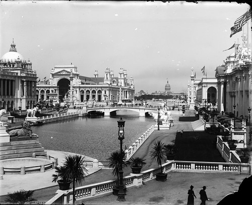
In the 1890’s however the trend shifted as the City Beautiful movement lead by Daniel Burnham took over with focus on the structural aesthetics of the city taking priority over parklands with grand buildings and designs a sign of wealth and prosperity as seen in Chicago’s transformation in 1893.


The next major two shifts in early planning showed similarities to modern day planning and evolved out of the emergence of reliable transportation which allowed residents to sprawl away from inner cities regions and live in small cities yet still within the region. This idea by Lewis Mumford allowed for the modernism of Le Corbusier who proposed and implemented the use of skyscrapers to save space and deal with the booming post war populations.

All these initiatives which have occurred between 1870 - 1940 have shaped the planning profession and urban life as we know it and the fact that these major shifts happened during two world wars and a depression is a monument to the early planners of the century

Wednesday, 14 September 2011

How Plan's Work

What are plans? How do they Work? Plans are the framework that control and guide development and growth. Plans give direction and formulate strategies to meet the potential of any given community’s needs. In Lewis D. Hopkins article The Logic of Making Plans, the structure behind a plan and the assessment of a plans success is evaluated as well as the plans relationship with regulations. Plans have 5 different mechanisms that shape its purpose and structure. All plans strive to have the follow mechanisms however it must be noted that not all plans contain each of the following factors:
1)      Agenda - a tool that helps focus the attention on what the task is at hand.
2)      Policy - a consistent decision making process.
3)      Visions - an image of what the final outcome should be.
4)       Designs -  a specific final outcome of a particular project
5)       Strategies - a decision process that chooses which desired path of planning to choose for the present and the future.
Regulations are also a major aspect of a plan as they are legal provisions that implement the desired intention of a plan. For example zoning regulations can prevent industrial buildings being constructed in certain areas which would be a factor in a city’s overall plan and therefore part of how plans work.
A plans success is often extremely hard to measure as differing people benefit from the plans aims in different ways. However there is a general formula of measuring a plans overall success.  The effect is one method which is measured by analysing if the intended outcomes were achieved.  The net benefit is another method which is hard to distinguish but is positive if the estimated benefits of the plan out way the costs. Then there is internal and external validity which consider one if the plan fulfilled the logic of how it was meant to work and two did the plan benefit those who need help e.g. bridge the gap between poverty and create equity. In all, plans follow and attempt to incorporate 5 basic principles that determine its focus for bettering communities. This focus can than although sometimes difficult be measured using the 4 principals mentioned above which can classify the success of a plan.


Friday, 2 September 2011

The Art of Planning


The Planning profession although relatively short in time has undergone mass change since the 1930’s to the present as it has had to adapt to the physical and technological growth of an ever changing  world and demanding societies. In Birch’s article Practitioners and the Art of Planning, the phrase, “The Art of Planning” in which art is defined as design (physical planning), craft (techniques and methods) and presentation (personal skills and attributes) is what distinguishes planning from any other fields or professions. It gives planning its identity which throughout the evolution of society has changed from a profession that only looked at the physical side of a town with no input from the public to a respected profession which incorporates the professions of architecture, economics and environmental science whilst mediating for a sustainable environmental, economic and sociable society. Such change and adaption has been documented in different volumes of the planners “Green Book” since the 1940’s with Cincinnati planner Ladislas Segoe's initial edition containing only information on the technical side of planning which involved diagnosing physical planning problems and then finding solutions. The next substantial transition which again is highlighted in the Green Book is in the 1960’s and 1970’s where industrial restructuring and edge city growth (suburbanisation) began to blossom which lead to planning focus and initiatives such as urban renewal and decentralisation. The 1980’s, 1990’s until present was another major planning transition which lead to more specific specialisations in the profession that focused on environmental planning, urban design, transportation, economic development, advocacy and political policies. As you can see overtime the art of planning which is the design, craft and presentation has adapted throughout various transitions throughout the century to meet the needs of society and create sustainable communities. These days planning is a complicated mix and balance of social, economic and environmental issues that need to be dealt with whilst still meeting the needs of the current communities and future generations.  


Introduction


Planning plays a pivotal role in creating live-able communities, vibrant economies, sustainable places and diverse cultures. This planning blog is designed to explore these aspects and the history of the profession of Planning with reference to articles from Eugenie. L. Birch’s The Urban and Regional Planning Reader. Each week a variety of readings and topics will be summarized, discussed and open for opinion and scrutiny for you the public. Explore, take in and enjoy!